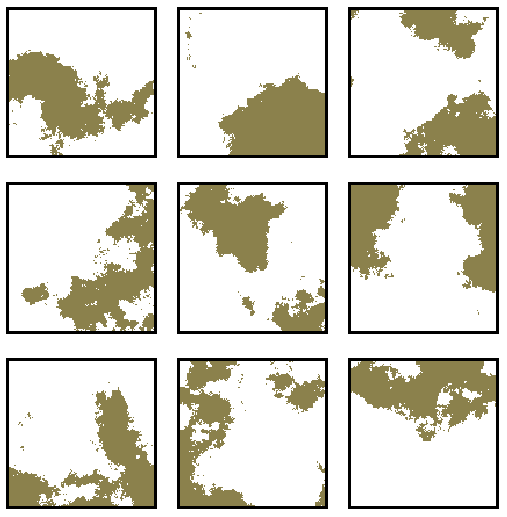
We hope that you had at least some difficulty selecting the real landscapes, and that the fractal realizations represented reasonable facsimilies of the actual landscapes. Linear features and inter-category associations among features are two characteristics of some of the real maps that are not easily simulated by the Realizer.
Linear features like stream channels can provide important clues for selecting the real maps from their fractal realizations. Fractal patterns are everywhere self-affine, and are isotropic in all directions. Anisotropies like linear features cannot be well-represented with fractal models, and will not accurately simulate the real landscape.
For this reason, the Fractal Realizer accepts constraint layers which specify the positions of map categories with linear or anisotropic features. Constraint layers are spatial probability maps which contain only two values: on and off. You may have noticed that some of the synthetic maps matched particular color categories of their real map counterparts exactly. During the Turing Test, the white background category was always preserved with a constraint layer, and sometimes the positions of additional categories were also constrained.
But the constraint layers could be used in other ways as well. For instance, digital elevation was used to constrain some categories for some maps in the Turing Test. Since they can contain the full range of probabilities, constraint layers can be used to provide other, non-fractal types of spatial probabilities to the Realizer. For example, one could provide a Poisson, or a negative binomial, or any other spatial probability layer, and it would be combined with the other categories to generate the synthetic map.
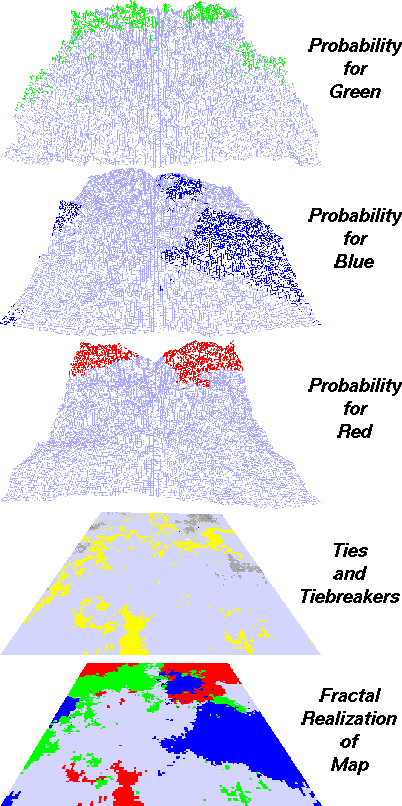
The example at right shows graphically how the Fractal Realizer produces a synthetic realization of a three-category map. The user has requested that each of the three categories have a proportion of occupancy, p, equal to 20% of the map (p = 0.20). The user has also specified the fractal dimensions for the three categories to make them rough, intermediate, and smooth respectively.
The top 3 layers in the stacked diagram represent single stochastic representations of fractal probability surfaces generated with the appropriate Hurst dimensions. The topmost (green) surface is the roughest, at H = 0.55, and the third (blue) surface is the smoothest, at H = 0.95. These fractal probability terrains have been horizontally sliced such that 20% of the map area remains above the horizontal plane. It is as though these terrains were flooded with water until only the peaks, or most probable sites, were left protruding.
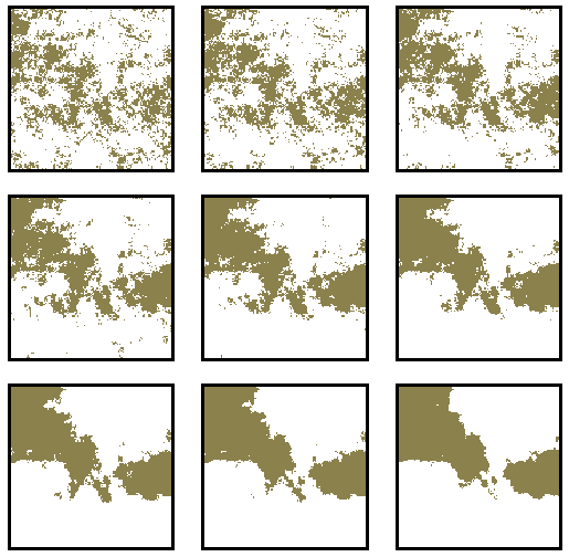
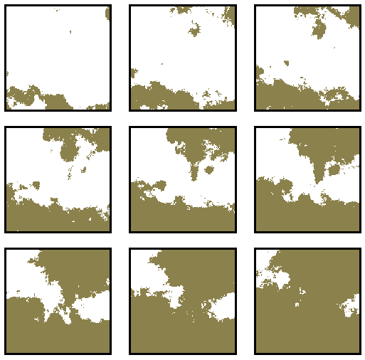
The fractal surface generator uses the midpoint displacement algorithm of Voss. These examples show the effect of holding p constant and changing H from 0.20 through 0.90, and of holding H constant and changing p from 0.20 through 0.90 with the same random number seed. By changing the random numbers, different stochastic realizations are produced.
The high-probability sites for each category may overlap one another, creating contention among the three categories for the same cells. The fourth layer in the stack indicates these tied cells as gray levels, where the darkness of the gray indicates the severity of the contention for that spot. The Fractal Realizer arbitrates these ties in order of their severity, assigning losing categories to the yellow cells. Therefore, there are at least as many yellow cells (tie-breakers) as gray cells (ties) in this layer--more if there were 3-way contentions.
The synthetic map which has resulted is at the bottom of the spatially-registered stack. Notice that the red patch in the foreground was not called for by the red probability terrain, but resulted from the arbitration of collisions at the back edge of the landscape. Nevertheless, these cells represented a highly probable area for the red category.
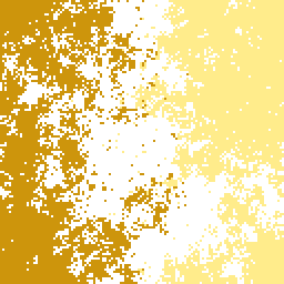
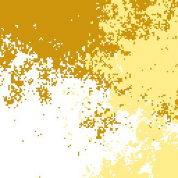
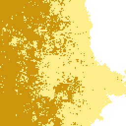
The Fractal Realizer can also be used to generate multi-category gradient landscapes. These landscapes resemble ecotones or ecoclines, where one land cover intergrades into another. Gradients can either be in opposition (180 degrees), in contention (90 degrees), or in concert (0 degrees). In the gradients in concert example, the brown/yellow border has an H of .72, while the yellow/white border has a ``smoother'' H of 0.95. A pair of gradients in contention with H = 0.95 produces a smooth, nearly 45 degree intersection line.
For additional information contact: